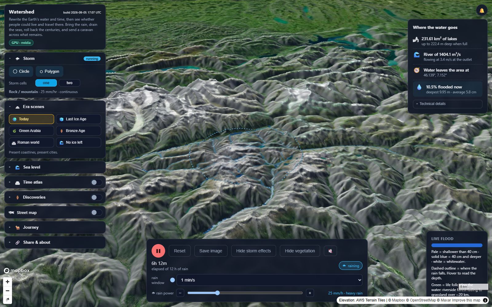
Watershed is a rain and flood simulation sandbox. Make it rain anywhere on real terrain (deserts, mountains, forests) and watch where rivers, lakes and flash floods form.
Every valley is the shape of rain that already fell. Every coastline is the height the sea happened to be. The first roads went from one well to the next, and many of them are still roads.
Rain on a real mountain and watch it run to the sea. Drain the Gulf back to the Ice Age. Roll the atlas to the Bronze Age and send a caravan across what remains, in the year you choose.
These are teaching sandboxes. Every layer shows where its data came from. Where a model is rough, the app says so, in plain words, before you trust it.
Draw an area anywhere on Earth, pick a storm, and watch real elevation data fill its valleys. Water runs downhill and gathers into rivers that find their way to the sea. Then drain the oceans back to the Ice Age, roll the atlas back three thousand years, and see whether people could live and travel there.
Bring a storm to any real landscape and watch the rain gather and flow downhill.
iPhone and iPad ยท $4.99 ยท Education
A calm balloon game for iPhone and Android. Tap colourful balloons, keep them floating over a quiet garden, and play at your own pace.
More instruments are on the bench. They will share the same rule: real data, sources shown.
Terrain from public elevation surveys, imagery with its provider named, historic sites from open registers. The source of every layer is one click away inside the app.
Water is not an animation. It is a shallow-water solver running on your graphics card, with friction, infiltration and evaporation, and you can pause it and probe any point.
Nothing here is a calibrated engineering model. The apps say so, and they show you the assumptions rather than hiding them behind a confident picture.
Licences for a class, a question about the data, or a place you think we should look at:
info@mozonapp.com